The Larapinta trail is a true wilderness wonder of the Australian desert. It runs for about 223 km through the West MacDonnell Ranges and allows you to walk through ancient landscapes, discover indigenous culture and experience the remoteness of the Northern Territory’s wild.
The Wonders Of Larapinta Trail trip
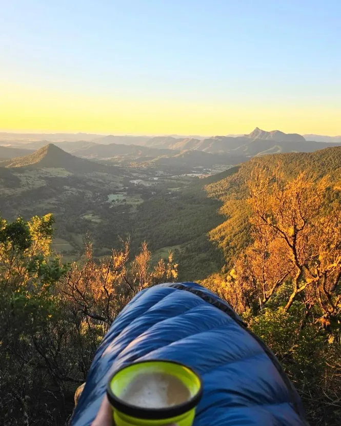
Larapinta Trail has some of the best views in Australia, from rocky ridges in the West MacDonnell Ranges to calm, still water holes like Ellery Creek Big Hole or Ormiston Gorge. This ancient landscape features the vast Finke River and Mount Sonder standing tall; these are just a few of the many sights you’ll experience on this trail, where you’ll feel like a tiny speck amidst the endless space of outback Australia. For an immersive adventure, a Larapinta Trail Trip offers the perfect opportunity to explore these breathtaking landscapes and connect with the rugged beauty of the Australian wilderness.
Some Sections of Larapinta Trail
Here are a few different sections of The Larapinta Trail.
Alice Springs to Simpsons Gap – Easy walking with great views of the surrounding ranges to get you started on this trail. Notable features are a narrow bush track and natural beauty at Simpsons Gap.
Simpsons Gap to Standley Chasm – Cultural significance and rock formations. Walk with traditional owners and explore Standley Chasm’s landscape.
Standley Chasm to Ormiston Gorge – Rocky and flat terrain along this section; highlights are the views from Ormiston Gorge itself and Ormiston Pound.
Ormiston Gorge to Redbank Gorge – Lots of gorges on this bit due to uneven surfaces that are tough but offer great views. Redbank Gorge gives you real wilderness feel.
Redbank Gorge to Mt Sonder – In the final stages, Mount Sonder tops out with 360-degree views and a sense of accomplishment. You’ll have tough climbs with unique views of outback skies in this section.
Old Landscapes And Natural Wonders
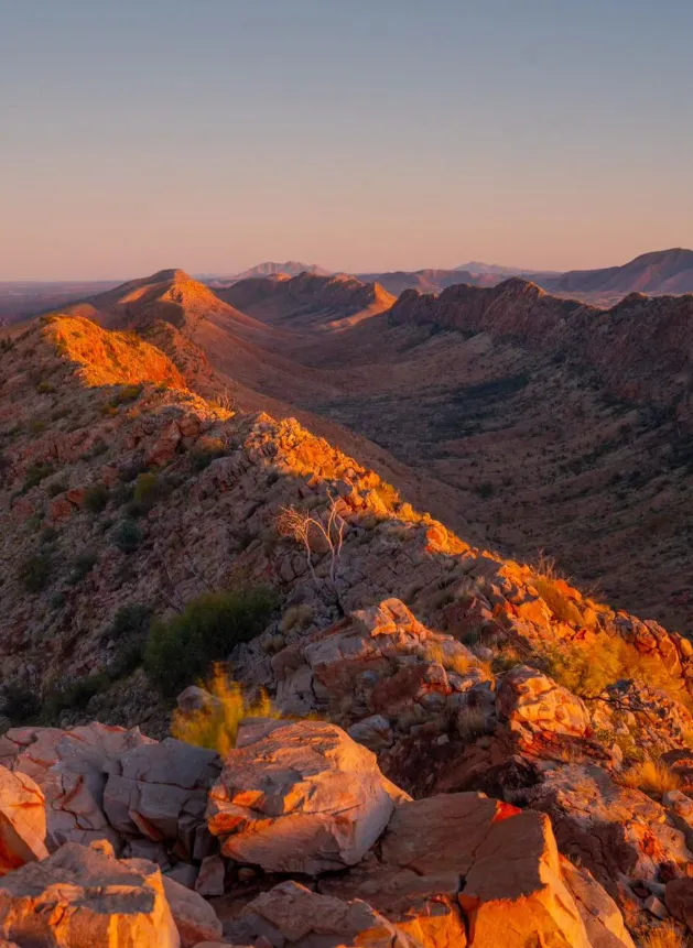
Larapinta Trail is a nature showcase in the middle of Australia. What’s more ancient than the rock formations in Serpentine Gorge or the view from Razorback Ridge? Larapinta Trail has natural beauty – the rocks at Standley Chasm, the open desert from Euro Ridge. The trail has several natural attractions – lush waterholes like Ellery Creek Big Hole or Birthday Waterhole.
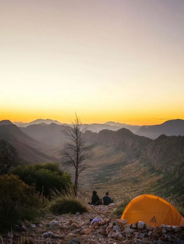
Outback Camping
Camping on Larapinta Trail is part of the experience. There are several places to camp along the way – Nick’s Camp and Miller’s Flat for rest stops. Make sure you have camping gear – a torch, sturdy hiking boots, and a day pack with weights for outback camping. Water tanks are at some campsites, but they always carry enough water, and different wind conditions are expected on the trail. Some campsites may charge, so make sure to follow the instructions for camping responsibly.
Larapinta Trail Facilities
Support is provided along the Larapinta trail for hikers. There are water supply points and some sections have basic facilities like compost toilets. But you will need to be self sufficient in remote areas. A pre-trip briefing at 3:30 pm is mandatory for all hikers to ensure your safety and preparedness. Make sure you bring a big camping gear list, fresh salads and consider the trail conditions and fitness level for each section.
Highlights
The Larapinta Track lets you experience the raw Australia and feel the spirit of the outback. Whether you’re scrambling over rocks in Hugh Gorge or taking in the views from Heavitree Range, every bit of this trail is special. It’s a tough walk, beautiful landscapes and cultural heritage. Use it because the Outback is magic, and this is what it looks like in Australian history through Aboriginal eyes.
Larapinta Trail facts
Ormiston Gorge
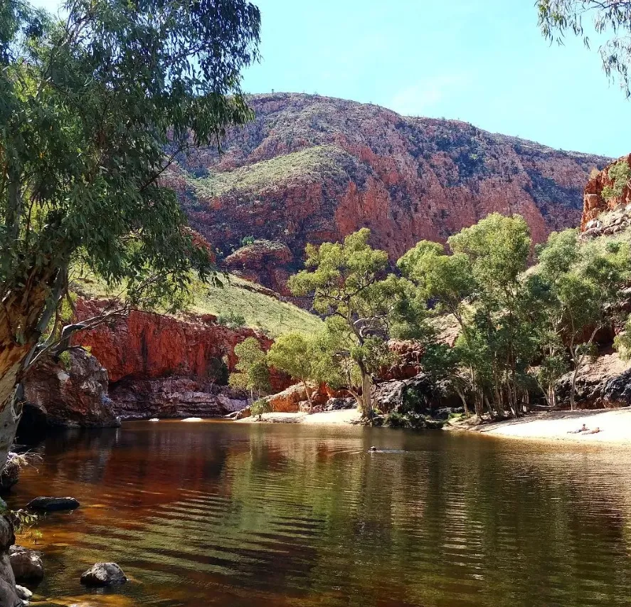
One of the many favourite spots along the Larapinta trail is Ormiston Gorge. Hikers, swimmers and birdwatchers love it. The gorge has a great waterhole where the sun doesn’t shine and is perfect for a swim after a day of walking in the heat. Rugged rock formations stretch out in the desert landscape, fringed with green.
Ormiston Gorge has walks for all abilities and ages and swimming and wildlife watching. For example the Ghost Gum Walk is short but has great views of the hills of the gorge. Or if you like a challenge try the Ormiston Pound Walk which takes you through rocky outcrops and open plains with river beds of ancient watercourses.
Mount Sonder
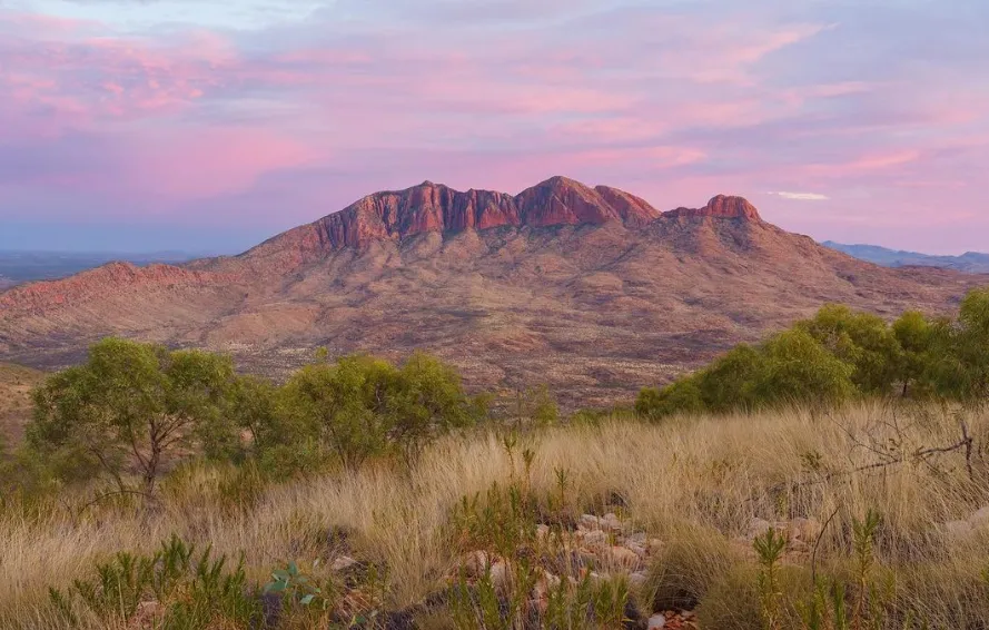
Mount Sonder the highest peak of the West MacDonnell Ranges is one of the highlights of the Larapinta Trail. This big mountain is 1,379m (4,528ft) and a challenging climb. The stamina sapping climb to the top is worth it for the views.
It takes about 6-8 hours to get to the top of Mount Sonder, depending on how fast and what the weather is. This trail can be tough but is well signposted, so make sure you bring enough water, good shoes and clothes for all weather. For many people doing the Larapinta Trail getting to the top of this mountain is a big tick.
Finke River
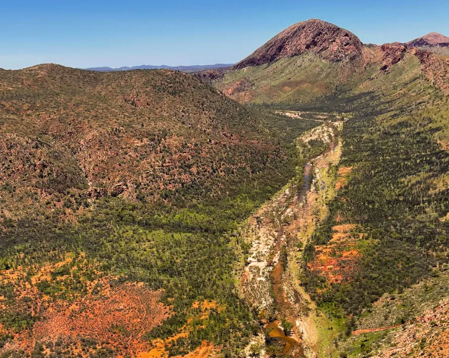
Running through the Larapinta Trail, you will see that the Finke River is one of the oldest rivers in the world. This is the natural history of the area. It’s so important in this desert landscape because it’s the only thing that flows and visually stands out.
The vegetation around the Finke River is home to many species of plants and animals. The riverbanks are lined with thick reeds and trees making it a beautiful and peaceful place to be. Tourists can either walk quietly along the banks alone or view the interesting geological formations created by water erosion.
Serpentine Gorge
When talking about Serpentine George you can’t help but mention the rock formations and the silent pool so it’s peaceful in the middle of the outback. The gorge is a narrow entry that winds its way into a dreamy waterhole surrounded by cliffs. Here you can relax and take in the view or listen to the sound of the waves.
Serpentine Gorge is a favourite of photographers because of the geological features that create striking contrasts in colour and texture of the rocks. Make sure you take a dip in the swimming hole even if the swimming conditions change from time to time depending on the season and recent rainfall.
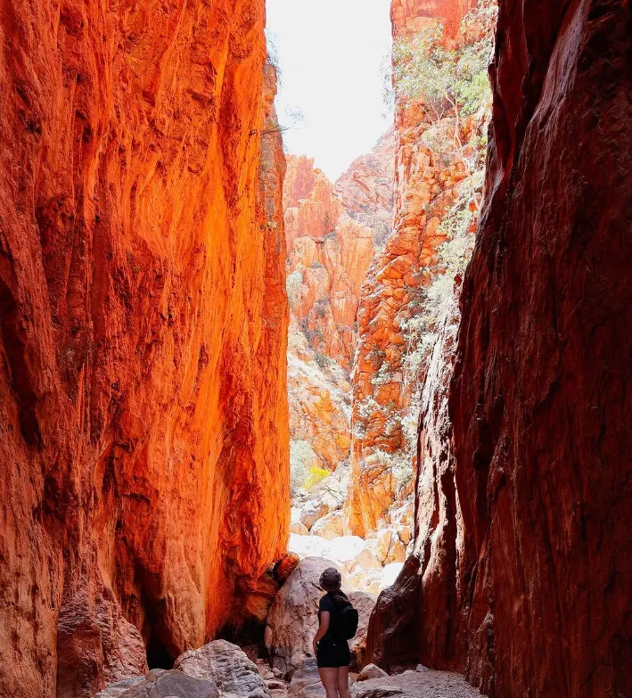
Standley Chasm
The sun makes Standley Chasm a narrow canyon with red rock walls that are lit up at noon. Standley Chasm is one of the highlights of the Larapinta trail. The walls are weathered ancient sandstone.
Directly in the sun mid-sky the colours become more vivid, the intricate patterns on the stone surface are revealed; so it’s stunning visually because of the contrast between the dark shadows and the orange-red tints they have.
Simpson Gap
The cliffs are the main feature of Simpson’s Gap. The Larapinta trail passes through Simpson’s Gap which is a landmark for those who want to see the scenery and geology. The cliffs are so different to their surroundings and are a great photo opportunity or view of nature.
Simpson’s Gap has several tracks of different lengths and difficulties that hikers can use to walk around the gap and its surrounding area at their own pace. In some cases, this means one person may want to take an easy stroll along one of the easier walks while others will choose the more challenging ones that cover both natural and cultural aspects within the gap itself.
Euro Ridge Lookout
Euro Ridge is a great vantage point on the Larapinta Trail with views of the surrounding landscape. It’s a popular spot because tourists can see the West MacDonnell ranges and outback scenery.
It’s a tough hike but it’s worth all the sweat; you’ll get to see one of the best views in the world at the top. On this level you get to see desert landscapes with mountains far away, rocky outcrops and flat plains.
Old Telegraph Station

Lots happened in this area and Old Telegraph Station is a record of some of it. It was part of the Overland Telegraph Line that connected Northern Australia to the Southern coastline in the 19th century and was Australia’s main transcontinental communication route.
To keep its place in the country’s communication history the old telegraph station has been preserved for display. Visit and see what life was like for telegraph operators in the original buildings which are still standing.
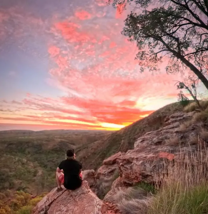
Counts Point
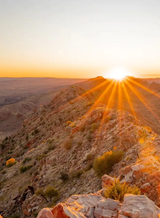
Counts Point gives you a sense of how big the desert is. This is a great spot to take photos at dawn or dusk, as the broad horizons allow you to capture all the colour changes in the sky.
At Vantage Point you’ll have a clear view out to the distance over arid landscape with isolated rock outcrops, distant mountains and flat desert plains. A learner who walks this path will come across Counts Point where they’ll encounter nature at its best.
Ochre Pits
The Ochre Pits are full of multi coloured ochre deposits that have been used in ceremonies and paintings for centuries by indigenous people. The colours range from dark reds and yellows to rich browns and whites.
The cultural and artistic practices of the local Indigenous people can be understood through these sources of ochre. These ochres were used in various forms of art including rock paintings, body decorations and ritual objects.
Conclusion
More than a walking track, the Larapinta Trail takes you into the heart of Australia’s outback, where you can really connect with its natural beauty and culture. From the ruggedness of Mount Sonder to the serenity of Ormiston Gorge, this path has stunning views of ancient country and Aboriginal history. Whether you know nothing about walking or are an experienced adventurer, walking the Larapinta Trail will put you into real central Australia.
FAQ
When is the best time for me to trek along Larapinta Trail?
Normally, the months between April and October are considered good for walking on the Larapinta Trail as the temperatures are lower than those experienced in summer.
Do I need to be fit to walk it?
Different sections of the Larapinta trail vary in difficulty hence one needs to have an average level of fitness. The steeper parts require more effort and familiarity with walking on rocky tracks in other regions.
What should I pack?
A comprehensive list should include, among other things hiking boots, camping gear, head torches, enough water supply and clothes suitable for different weather conditions. Also don’t forget a correct map and first aid kit.
Are there any facilities on the track?
There are very limited facilities along this path. Some campsites may have basic amenities like composting toilets and water tanks but you must be fully self-sufficient in remote areas.
Can I bring alcoholic drinks with me on this trail?
For safety reasons about their disposal as well as environmental concerns, alcoholic drinks are generally not allowed while hiking Larapinta. Therefore, try taking fresh, non-alcoholic fluids without spirits, which keep one hydrated instead.